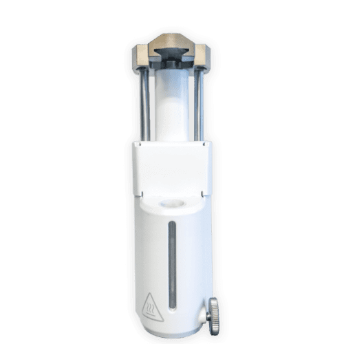
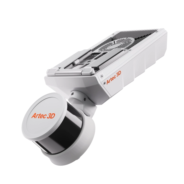
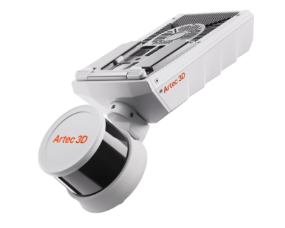
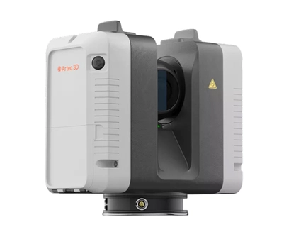
Artec Jet
Artec Jet
High-precision SLAM LiDAR scanner for any environment
2-year warranty
1.9 million
points/second scan speed
5-10 mm
global accuracy, up to
0.5–300 m
scanning range
From real scenes to digital twins in minutes
The Artec Jet is a high-speed mobile LiDAR system that uses SLAM and AI to capture survey-grade data in minutes, even without GPS. Its lightweight design allows for handheld use or mounting on drones, robots, and vehicles, enabling safe mapping of hazardous or inaccessible areas across the mining, construction, and defense sectors. This versatile tool produces precise data for digital twins, inspections, and volumetric analysis. Combined with the Artec Ray II and Leo, it forms a complete professional pipeline for digitizing everything from massive infrastructure to intricate components.
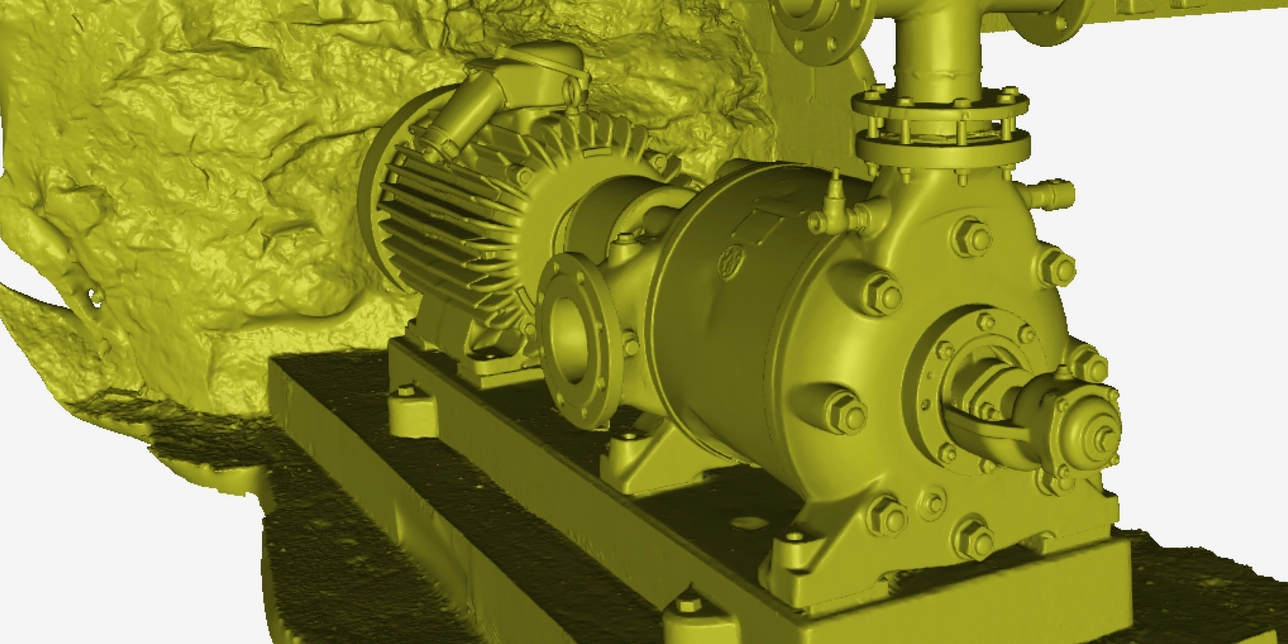
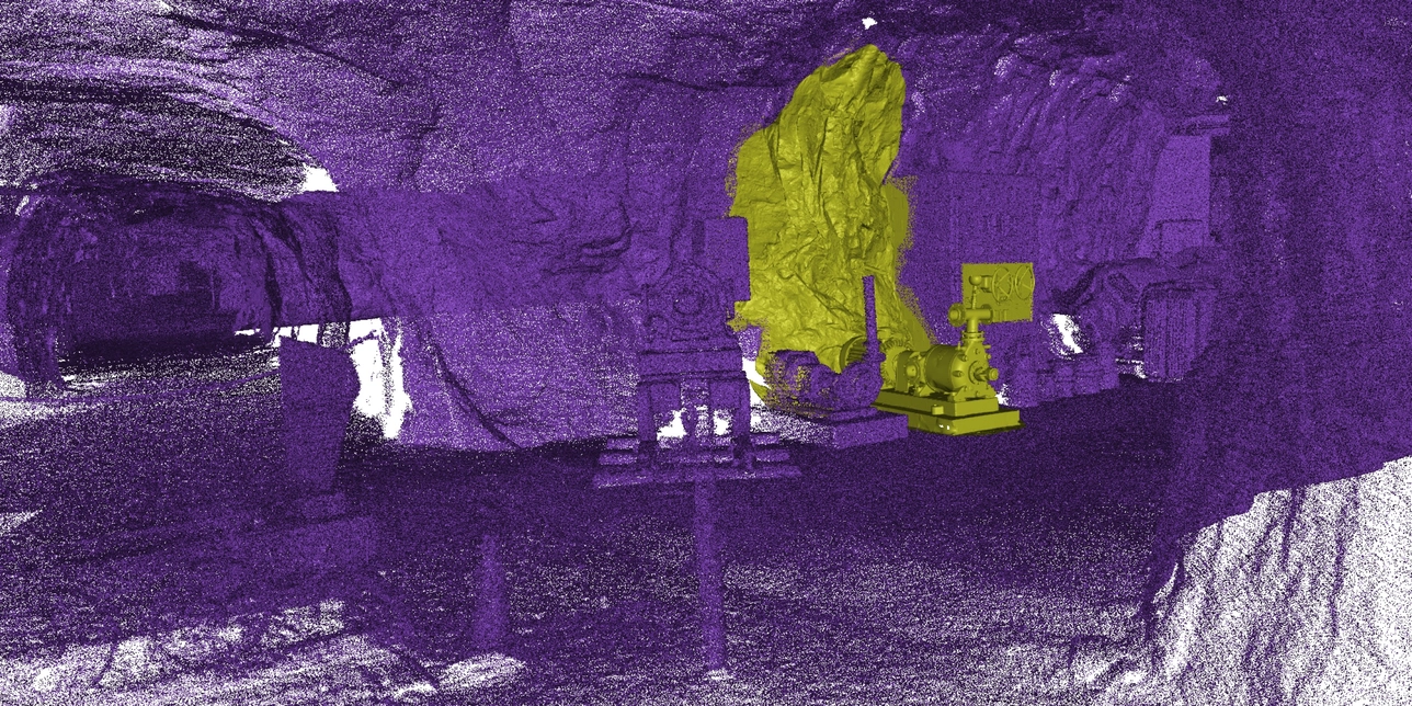
Capture at speed with survey-grade accuracy
Artec Jet’s high-resolution LiDAR sensors and industry-leading SLAM technology deliver detailed point clouds at high speed – for reliable data capture over wider areas in less time.
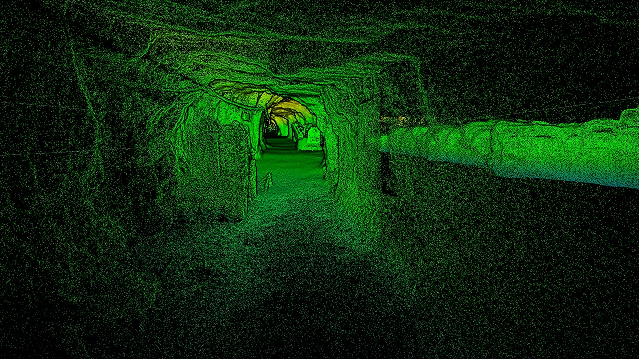
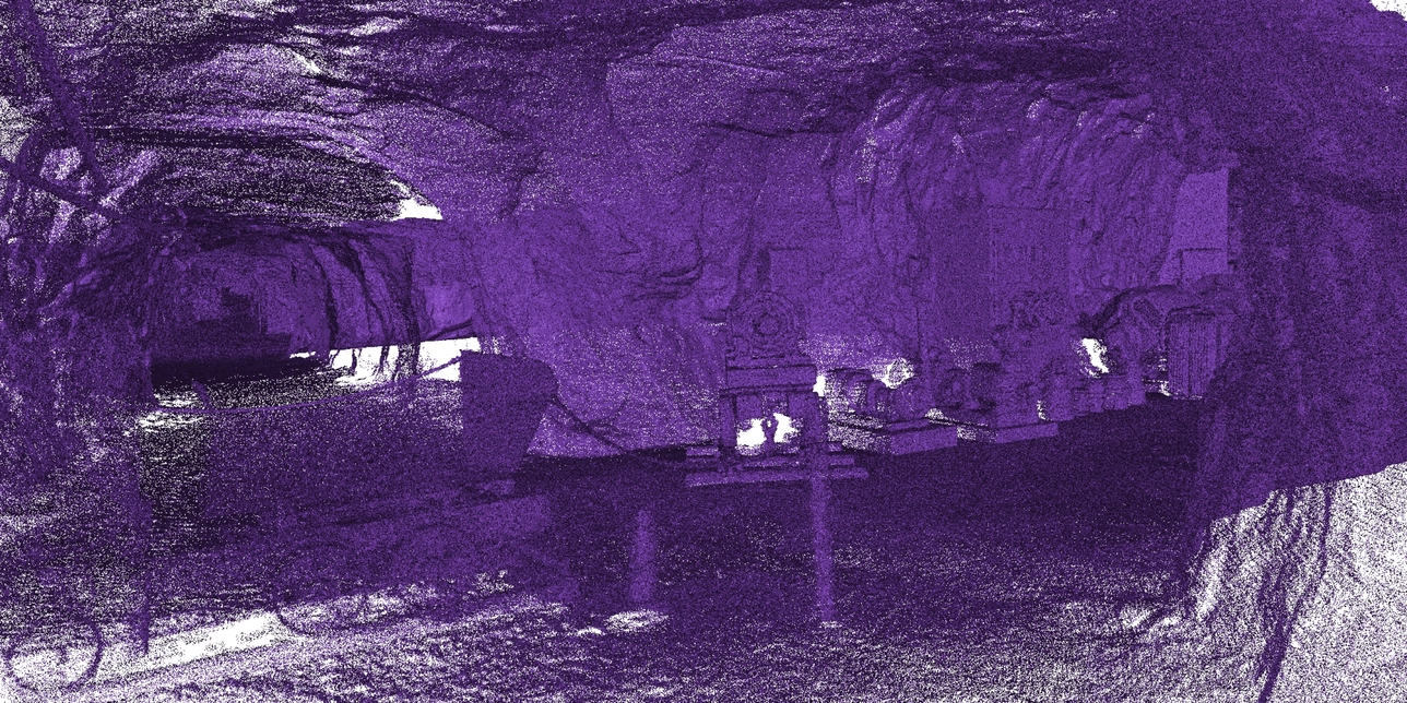
Underground
tunnel
mapping
| Mapping accuracy (general environments) | ±15 mm (19/32 in) |
| Mapping accuracy (indoor/underground) | ±10 mm (3/8 in) |
| Change detection capability | ±5 mm (7/32 in) |
| LiDAR range | 0.5–300 m (1.6–984 ft) |
| Data acquisition (single return) | Up to 640,000 pts/s |
| Data acquisition (triple return) | Up to 1,920,000 pts/s |
| Field of view | 360° × 290° |
| Laser class | Class 1 (eye safe) |
Digitize any environment without exception
Gather accurate data anywhere, in any conditions, without having to rely on external infrastructure such as GPS mapping and guidance.
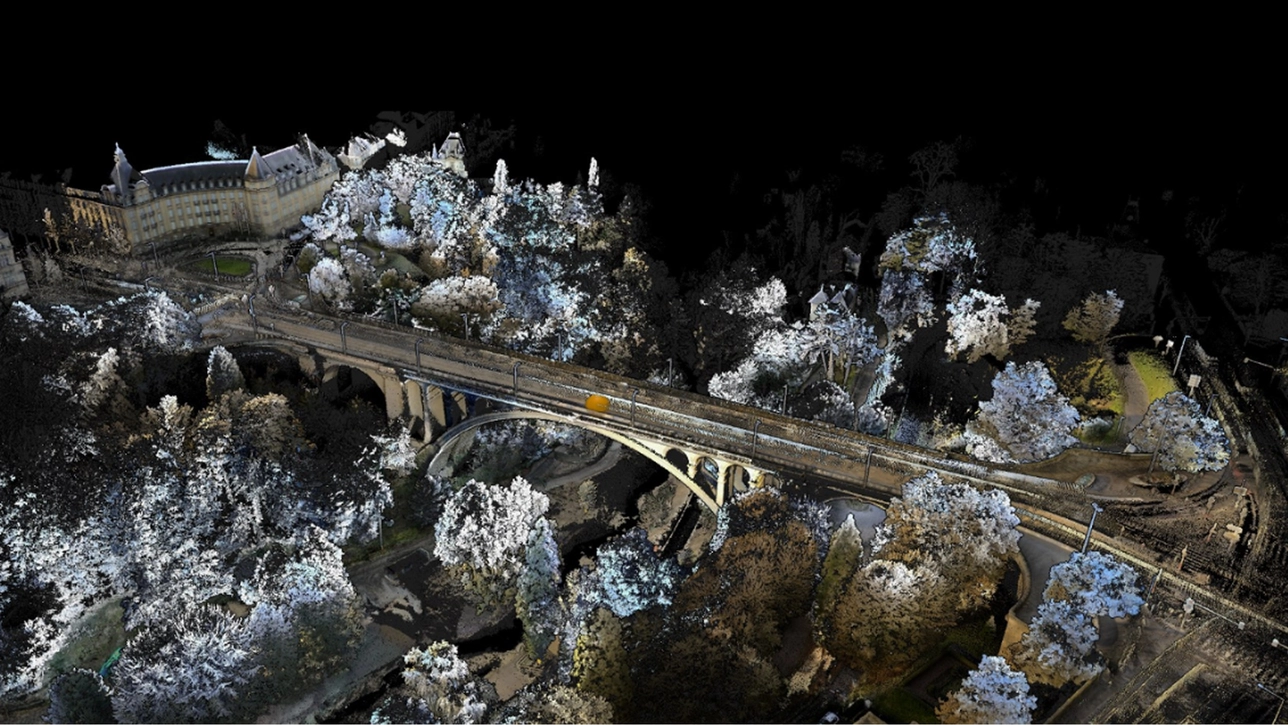
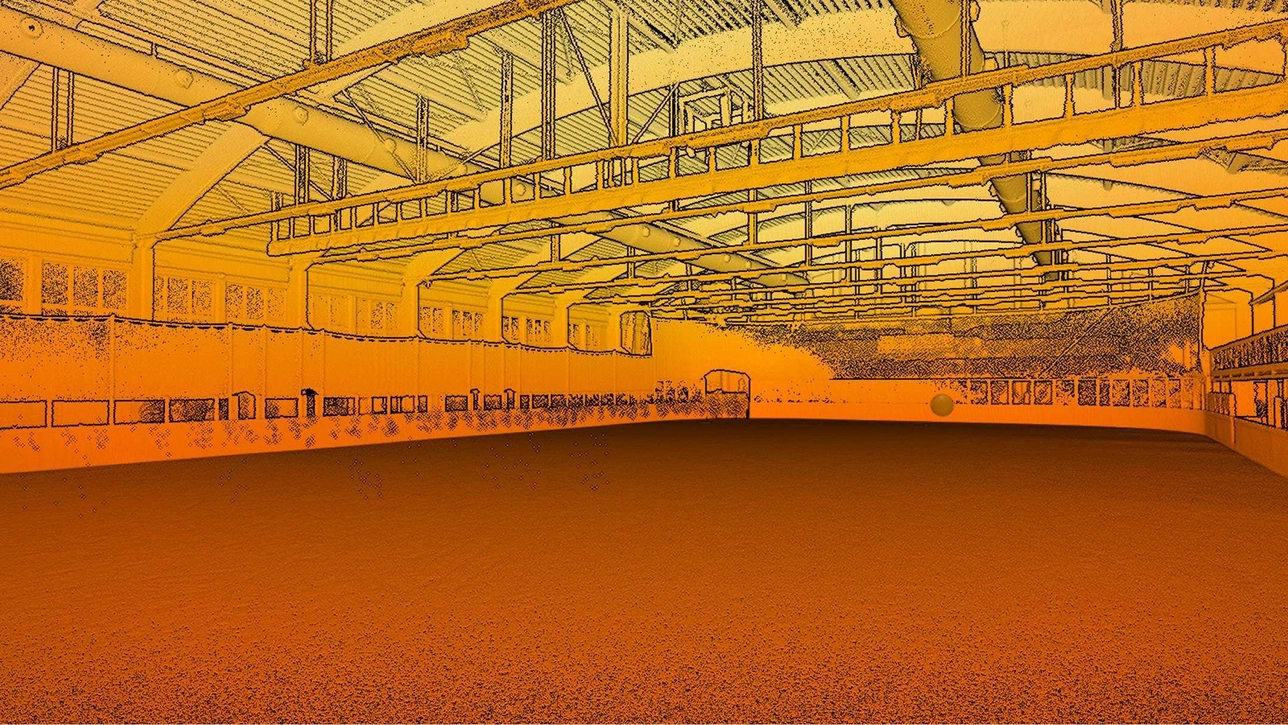
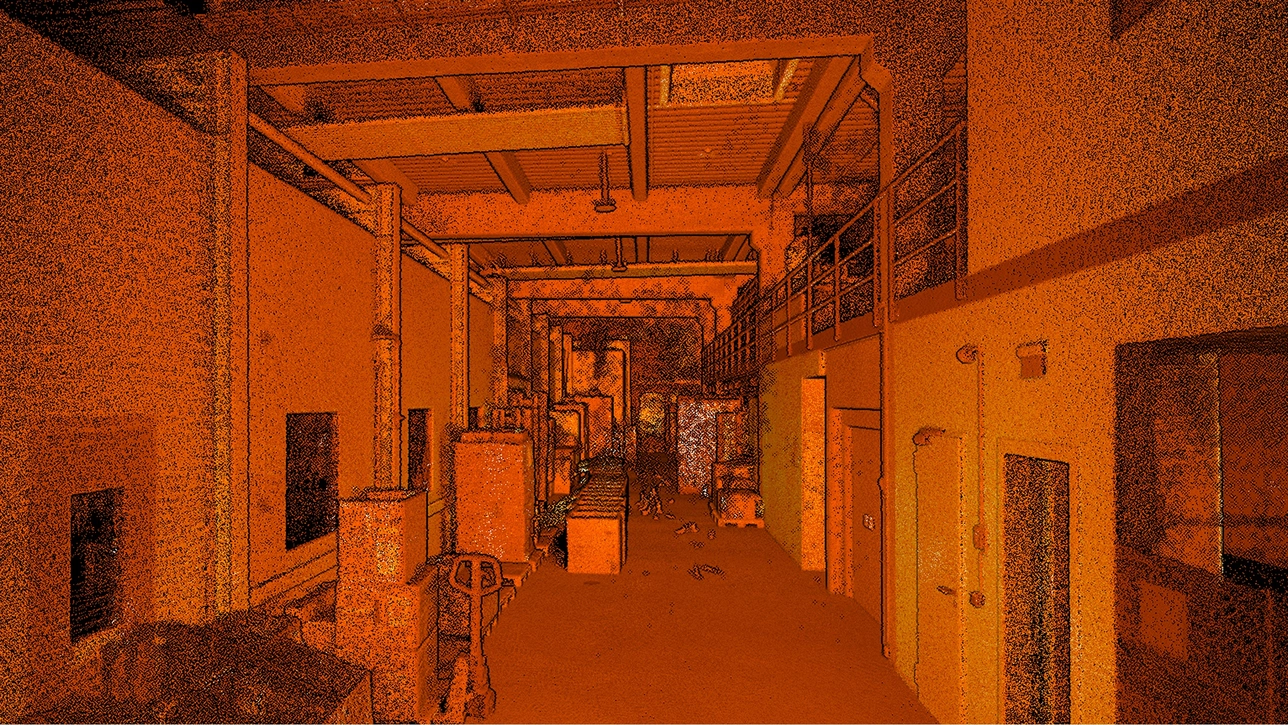
Whether you’re capturing large machinery, vertical shafts, factories, open-air sites, or road networks, Artec Jet scales effortlessly to match the scope and complexity of your project. Access environments that are difficult to reach or dangerous to enter — and scan critical assets with a single device built for the toughest conditions.
IP65
Dust and water-resistant
Protected from debris and moisture for consistent results
Operating temperature
-10°C to 45°C (14°F to 113°F)
Built for extreme working conditions
Weight
1.57 kg (3.46 lb)
Makes it easy to carry and provides longer flight time
Storage
512 GB
~16 hours of sensor data
GPS-free positioning
SLAM algorithms deliver positioning without satellites.
Zero-light operation
LiDAR’s active laser sensing needs no ambient light.
Confidence in every scan
Together, Artec Jet’s features, accessories, and advanced software ensure that you get the job done right, first time – boosting productivity and efficiency without scaling risk, cost, or operational friction.
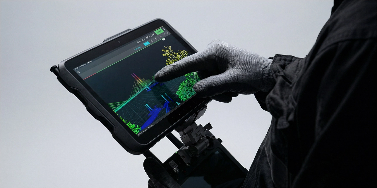

Real-time feedback
Artec Jet streams live point cloud previews to a companion app during scans, giving instant confirmation that all data is captured and no rescanning is required.

360° scene capture
With a 360° × 290° field of view, Artec Jet captures dense, shadow-free point clouds with full coverage in a single pass.

Color capture
Combine LiDAR data with imagery from a supported camera to create vivid, true-to-life 3D representations with immediately recognizable features.

GNSS-assisted georeferencing
Take advantage of satellite positioning with RTK accessories that improve global accuracy and reduce reliance on control points.

Instant proficiency
Push-button scanning with a plug-and-play design. No specialist training needed — start capturing quality data right away.

On-site verification
Preview each scan on-site before leaving to ensure complete, usable data is captured on every visit.
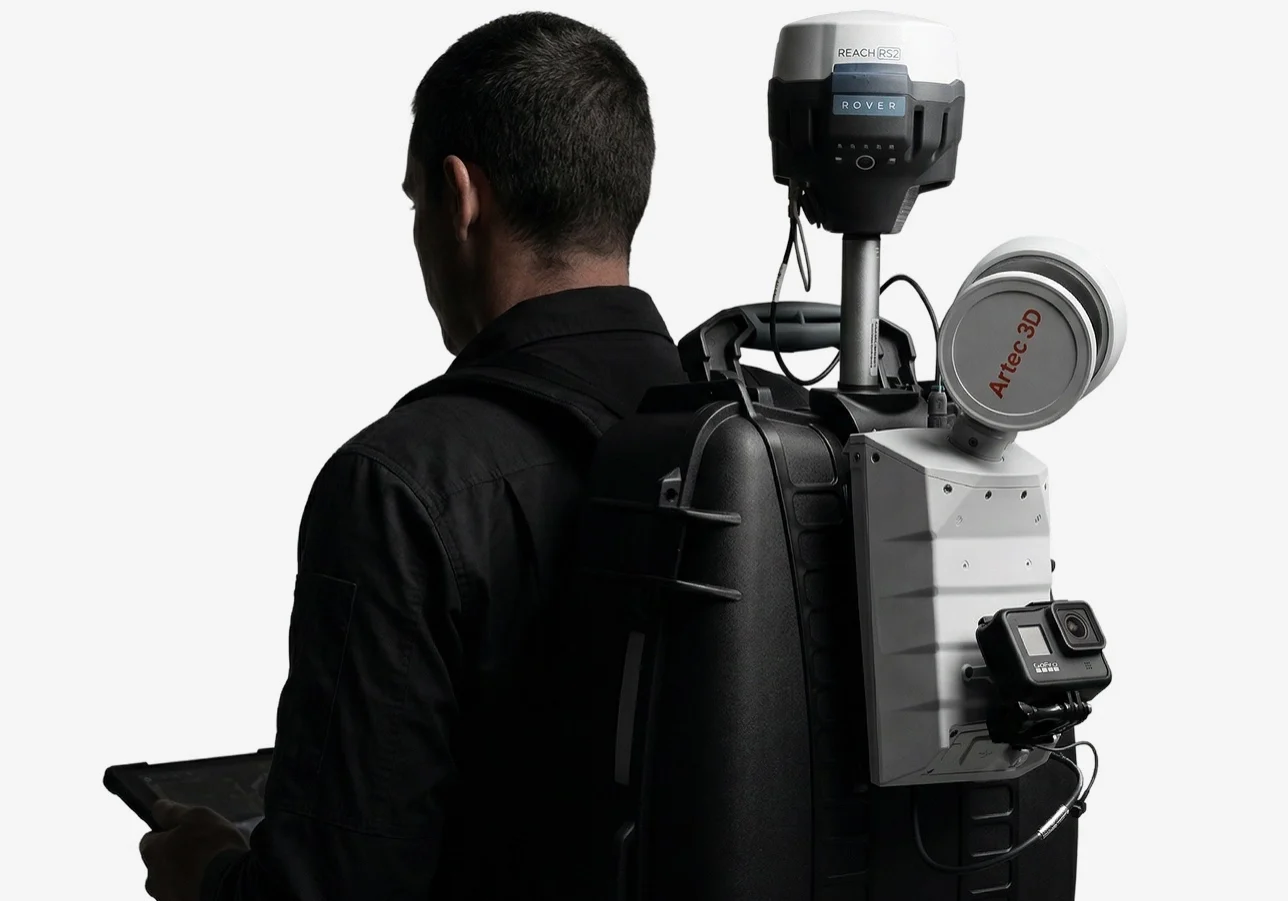
One portable scanner, seven ways to deploy
Artec Jet’s robust SLAM algorithms deliver reliable results across seven modes. Choose the modality that addresses your current project needs — and know you’re ready for whatever comes next. One device, one workflow, one investment.
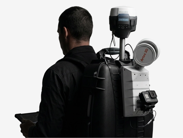
Backpack
Free your hands during longer surveys with a backpack SLAM LiDAR scanner. Pair with RTK or ground control points (GCP) for georeferencing above ground — and continue seamlessly into GPS-denied zones in the same session.
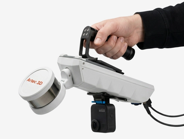
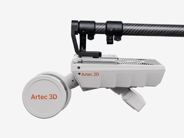
Handheld
Using a handheld SLAM LiDAR scanner, you can walk through and scan any space. At 1.57 kg, Jet is effortless to carry around buildings, facilities, and confined spaces.
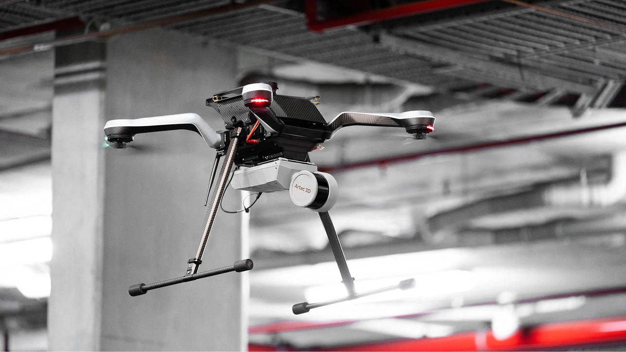
Drone
Access areas that are dangerous, elevated, or beyond line of sight with an aerial mapping solution. AI-powered autonomy provides collision avoidance and guided exploration — even in complete darkness.
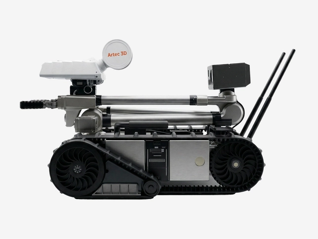
Robot
Mount onto platforms like the Boston Dynamics Spot to map confined or hazardous spaces without putting personnel at risk.
Telescopic pole
Reach ceiling voids, compact spaces, and infrastructure details up close. The telescopic pole extends Artec Jet’s range without a drone, improving point density in hard-to-access areas.
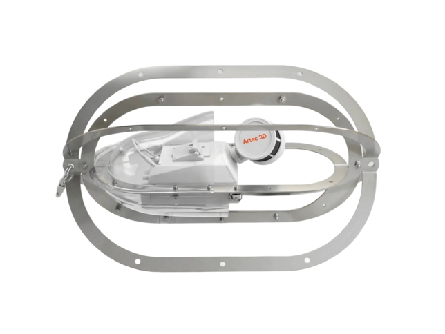
Cage
Lower your SLAM LiDAR scanner into vertical shafts, voids, and enclosed spaces. The stainless steel frame protects from impacts and slides smoothly to avoid snags.
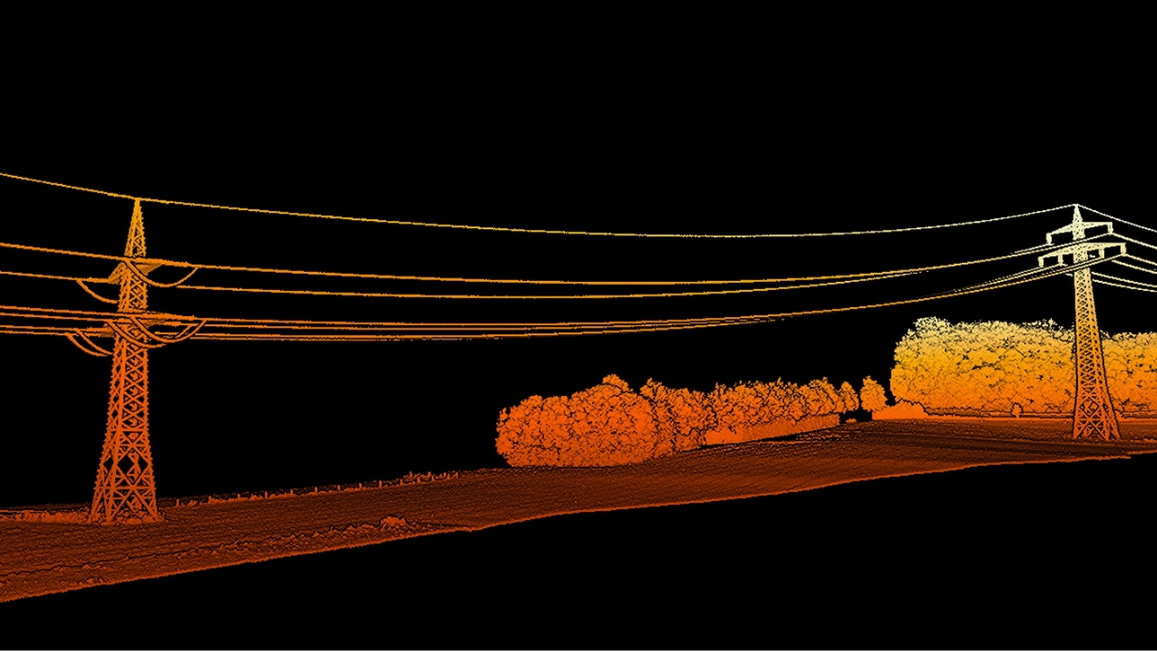
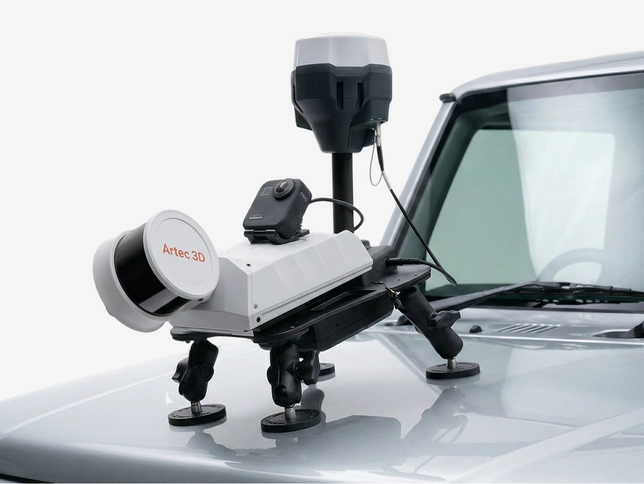
Vehicle mount
Capture roads, tunnels, large facilities, and linear assets at driving speed. RTK integration provides automated georeferencing and drift correction over distance.
Autonomous mapping beyond human reach
Artec Jet’s AI autonomy engine enables drones to reach the otherwise inaccessible, capture environments where GPS mapping isn’t possible, and keep your team safe – all without a pilot. Simply set waypoints, and the drone will fly autonomously, steering clear of obstacles.
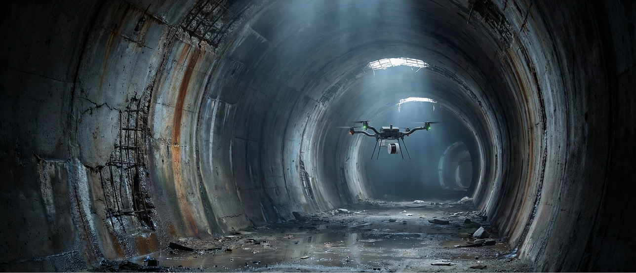

Collision avoidance
Omnidirectional LiDAR creates a safety bubble around the drone, detecting obstacles as small as 2 mm pieces of wire, allowing for confined space mapping. Your equipment stays protected, your data flow stays uninterrupted.

Beyond line of sight
Fly autonomously into areas beyond visual range using advanced path planning and proximity sensors to explore unknown environments – capturing data where operators physically cannot go.

Return-to-base failsafe
If battery runs low or conditions deteriorate, Artec Jet automatically navigates back to base along a safe, mapped route. No drone is ever lost, no data is left behind.
From site to component in one ecosystem
Artec Jet expands the Artec 3D ecosystem to cover everything from entire sites to component geometry, in one seamless workflow that delivers detail exactly where it’s needed, accurately and time-efficiently.
Artec Jet
Ultra-versatile SLAM-based LiDAR scanner for capturing large areas, including construction sites, road networks, and hazardous, difficult-to-access environments.
| Scanner type | Multi-modal |
|
Object size
Typical object sizes: |
XL, XXL |
| Accuracy, up to | ±10 mm |
Artec Ray II
Tripod-mounted LiDAR scanner for digitizing large objects and scenes ranging from turbine blades and vehicles to entire buildings — brings metrological accuracy to any area of interest.
| Scanner type | Stationary |
|
Object size
Typical object sizes: |
L, XL |
| Accuracy, up to | 1.9 mm |
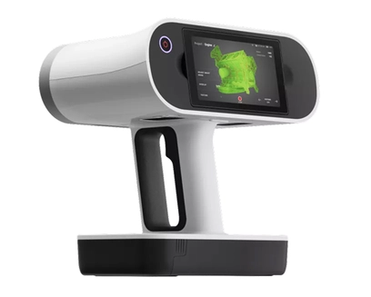
Artec Leo
All-in-one, wireless handheld 3D scanner for picking up detailed geometry and texture-critical surfaces when capturing parts and assemblies. Covers blind spots and achieves high accuracy on smaller-scale features.
| Scanner type | Handheld |
|
Object size
Typical object sizes: |
M, L |
| Accuracy, up to | 0.1 mm |
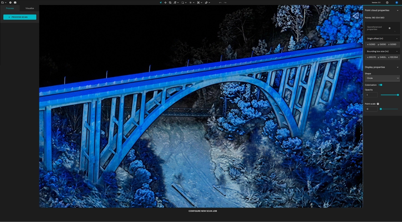
Artec Twins: Turn data into actionable insights
Artec Twins is a processing and visualization platform built for large-scale 3D data that powers the full Artec Jet workflow from raw point cloud capture to analysis-ready output.
© 2024 ALTEM TECHNOLOGIES PVT. LTD.
Engineering Phygital Transformation
© 2024 ALTEM TECHNOLOGIES PVT. LTD.